Jump to navigation

The University of Arizona Wordmark Line Logo White
Home


FacebookTwitterYouTubeInstagramLinkedIn     Donate

Search form

  • Minerals
    • Mining in Arizona
    • King Copper
    • Gold Prospecting
    • Industrial Minerals
    • Mineral Rights
    • Mining Scams
    • Potash Case Study
    • Ask a Geologist
  • Publications
    • All Publications
    • Recent Publications
    • Document Repository
    • Map & Database Services
    • Geologic Report Index
    • Geologic Map Index
    • Photo Gallery
  • Center for Natural Hazards
    • All Natural Hazards
    • Earth Fissures & Ground Subsidence
    • Landslides & Debris Flows
    • Floods
    • Severe Weather
    • Problem Soils
    • Volcanism
    • Earthquakes
    • Radon
    • Homeowner's Guide
    • Ask a Geologist
    • Arizona Council on Earthquake Safety
  • Outreach & Geoheritage
    • Arizona Geoheritage
    • Educator Outreach
    • Public Resources
    • Ask a Geologist
    • Photo Gallery
  • Energy
    • Energy Resources
    • Geothermal
    • National Geothermal Data System
  • Basin Analysis
  • About
    • About AZGS
    • Projects
    • Events
    • News
    • Contact
    • Ask a Geologist
    • Staff
    • Services
    • Partners & Funders
    • Employment
    • AZGS Smartsheets
  1. Home
  2. Minerals

Ask a Geologist

Do you have questions about the minerals, rocks, valleys, canyons, mountains, rivers, volcanoes, earthquakes, earth fissures, landslides, or natural hazards of Arizona? See our most commonly asked questions and answers. Don't see what you're looking for? Ask us! If our staff can’t answer the question, we’ll try and find someone who can. 

*Please note that we no longer have the staffing to provide individuals with specific mineral or meteorite specimen identifications. If you think you have a meteorite, you can consult this guide from Geology.com.

To provide an image file, first select "Choose File" to find your image and then "Upload."
Files must be less than 500 KB.
Allowed file types: gif jpg jpeg png.
By submitting a question to "Ask a Geologist," I give AZGS permission to publish my question on the Ask a Geologist Q&A page. No personally identifiable information will be displayed other than a first name, if provided.
CAPTCHA
Please let us know you aren't an automated spam bot by answering the question below. Letters are case insensitive.
Image CAPTCHA
Enter the characters shown in the image.

Common Questions & Answers


How much water required in mining gold?

I am a water resource specialist with ADWR.  One of my responsibilities is to calculate the amount of water being used in groundwater basins based on our water demand sectors of municipal, ag, and industrial uses. these basins are outside the AMAs so groundwater pumping is not required to be reported.   The Upper Hassayampa/Aqua Fria Basin has many gold mines.  Specifically, I hope you have an estimate of how much water a gold mine uses, based on type (i.e. underground, placer, screening plant, etc.).  I need just a rough estimate.

AZGS Answer

Hi Cyndi,

Thanks for your interesting question about water usage in gold mining. As a bit of background, managing water is one of the most important environmental considerations at mining operations. The most common uses of water in mining are in processing ore (e.g., grinding, flotation) and in watering mining roads to suppress dust (Stevens, 2010). The sources of water for mining in Arizona vary depending on the local geography, but include aquifers, Central Arizona Project (CAP), surficial waters, captured precipitation, and even water from the mine itself if the mine is being actively dewatered (Singh, 2010).

Estimates for average water consumption at a mine site vary considerably based on the processing method applied (e.g., heap leaching, flotation, gravity), but a global summary for water withdrawals for gold mines found the ‘average’ gold mine used ~0.350 m3/metric ton of ore-grade rock (Gunson, 2013). As such, the annual amount of water used will depend on how much mineralized material is being mined each year. While this doesn’t give a nice average use, it is more robust as it considers the size of the operation. The current water usage due to gold mining in the Upper Hassayampa and Agua Fria basins should be fairly low to our knowledge as there are no significant gold operations active in the area, with the historic gold mines in the area being defunct. What little gold production is happening is due to a few relatively small placer operations and rare, very minor pilot operations to test some of the historic mines. A larger source of water in the area is likely from industrial minerals (e.g., sand and gravel) mining operations.

Cheers,
Carson Richardson (AZGS Economic Geologist)

References:
Gunson, A. J., 2013, Quantifying, reducing, and improving mine water use: Unpublished Ph.D. dissertation, University of British Columbia, Vancouver, 258 p. URL: https://open.library.ubc.ca/cIRcle/collections/ubctheses/24/items/1.0071942

Singh, M. M., 2010, Water consumption at copper mines in Arizona, Arizona Department of Mines and Mineral Resources, Special Report 29, 16 p. URL: http://repository.azgs.az.gov/uri_gin/azgs/dlio/1295

Stevens, R., 2010, Mineral exploration and mining essentials: Port Coquitlam, British Columbia, Pakawau GeoManagement, Inc., 322 p.


Banded iron in Yavapai County?

Question: I have been collecting specimens of banded magnetite Jasper along orme road in Yavapai county. The rocks do not seem to come from this area. Where is the formation and how did my rocks come to be where I am finding them?


AZGS Answer

Chris,

I’m attaching a snippet from the USGS Mayer geologic quadrangle published in 1972. The Long Draw area is surrounded by sediment largely drawn from the Hickey Formation – mostly Miocene age basalts. There are banded iron deposits in AZ.

Below this map is a coarse map showing the iron deposits from AZGS Bull 180. You can retrieve the map and additional info from our Bulletin 180 - http://repository.azgs.az.gov/uri_gin/azgs/dlio/1005   See Part 3, p. 10 – 17 (p168 to 182 in the document.)
Good luck with it. Mike

U.S. Geological Survey Geologic Quadrangle Map GQ-996 U.S. Geological Survey Geologic Quadrangle Map GQ-996


Geologic map

Geocaching and conical hill in SW Arizona

As a retired person I'm involved in a activity known as Earthcaching. This is partly sponsored by the Geological Society of America and involves traveling to different geological features and answering some basic questions. One of these features I was directed to was just east of the Yuma Proving ground and the questions related to volcanic activity, this feature is located at 33.108983 -114.310528. My question for you is this hill the remnants of a cinder cone volcano as it's represented to be? I've not had any formal geology training but have completed several of these Earthcaches and what is represented as a volcano appears to me as a highly eroded mesa. I would appreciate if you could confirm or deny this location is volcanic in nature, thanks!

AZGS Answer

Hi Thomas,

Well it is certainly conical, but conical shape does not a cinder cone make. I copied the description for that area from our 1:1,000,000 scale map and pasted it below.

I don't believe this hill is or was a cinder cone. The rock debris certainly looks like basaltic rubble, but more likely to be associated with lava flows.  Mike

Middle Miocene to Oligocene Volcanic Rocks (11-38 Ma)

Lava, tuff, fine-grained intrusive rock, and diverse pyroclastic rocks. These compositionally variable volcanic rocks include basalt, andesite, dacite, and rhyolite. Thick felsic volcanic sequences form prominent cliffs and range fronts in the Black (Mohave County), Superstition, Kofa, Eagletail, Galiuro, and Chiricahua Mountains. This unit includes regionally extensive ash-flow tuffs, such as the Peach Springs tuff of northwestern Arizona and the Apache Leap tuff east of Phoenix. Most volcanic rocks are 20-30 Ma in southeastern Arizona and 15 to 25 Ma in central and western Arizona, but this unit includes some late Eocene rocks near the New Mexico border in east-central Arizona.


Geology of Phoenix's South Mountains

Hi, Can you point me to some geologic publications for the South Mountains of Phoenix? Nicole

AZGS Answer

Hi Nicole,

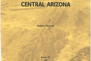
Steve Reynolds (Arizona State University) has a marvelous geologic map and accompanying description for the South Mountains.

Reynolds, S.J., 1985, Geology of the South Mountains, Central Arizona. Arizona Geological Survey Bulletin-195, 75 p., 1 map plate, scale 1:24,000.

And if you are interested, Julia Johnson field trip guide to the Phoenix Mountains is excellent, too.

Johnson, J.A., Reynolds, S.J., and Jones, D.A., 2003, Geologic map of the Phoenix Mountains, Central Arizona: Arizona Geological Survey Contributed Map CM-04-A, map scale 1:24,000, 16 p.
Enjoy the geology.
Mike


Cover, Phoenix Mtns

Erosion of Sandstones near Oak Creek Canyon, central Arizona

Good day, I stumbled across an interesting weathering pattern in some of the sandstone along the West Fork trail of Oak Creek earlier and I'm curious about what caused it. It looks like honeycomb weathering but it's isolated to a pretty small area at the bottom of a cliff overhang and from my understanding this type of erosion is only caused by salt exposure. Anyways I'm just curious what could have caused this.

Chris

AZGS Answer

There are two possible solutions (forgive the pun). Case hardening - where an amorphous silica gel precipitates locally resulting in areas of greater or lesser competency. In other words, the rock mantled by the silica gel is harder and more difficult to erode.  Alternatively, fractures (joints) in the sandstone will provide a conduit for naturally acidic waters to percolate through the rock. When those waters encounter lower permeability layers, the water seeps out of the rock causing local, lateral erosion resulting in alcoves as shown below. For illustrations and more detailed descriptions, download John Bezy’s 44-page “A guide to the Geology of the Sedona & Oak Creek Canyon area, Arizona’.  (Free to download) Case hardening and alcove formation are explained on page 29 and 30 respectively. Great question, thanks! Mike

Discovering geothermal data for U.S.

Do you have access to the data that could make a map of US geothermal wells and their types? (not just plants but physical wells). Connor


AZGS Answer

Hello Connor,

That data should be available through the National Geothermal Data System (NGDS) that AZGS and our partners AASG, USGS, SMU, among others,  build in 2010-2014 http://geothermaldata.org/.  There are about 10 million data objects in the NGDS including geothermal-related data from all 50 states.

Let me know if you are having trouble compiling those data. There are still one or two individuals around who designed the data structure and they may have ideas for teasing out that data.

Mike


NGDS

Mining Claims information - Federal Lands

I have contacted the recorder’s office at Pinal and Gila counties to see if they have the claim maps for given Township-Range-Sections but I have not received confirmation on this. I used the US BLM LR2000 system on-line to get the name of claims for a given T-R-S but the system does not provide the geometry and map of these claims.

Do you know where I can get the claim maps either on-line or in a hard-copy book to determine the exact layout of the claims within a Section?

Thank you,

Tony


AZGS Answer

Hi Tony,

BLM should have the info; they replaced the LR2000 site, but it is not as robust. You need to call or e-mail BLM office in Phoenix:  602.417.9200 or blm_az_asoweb@blm.gov They should have the data you are looking for.

Good luck with it.
Mike


Soil issue following rains from Rosa

We had a lot of rain in Laveen AZ 85339 last week.  My husband noticed a sunk-in area on our front lawn.  At least two to three foot around and about a foot or less deep.  The lawn was not washed away.  It is just sunk in.  Husband stepped in it and nothing happened.  Not what I would have done.  Do we need to be concerned?  Do we need to call anyone to check it out? Sherry

AZGS Answer

Hi Sherry,

Examining Google Earth imagery, it appears that Laveen Village is built on former agricultural fields northwest of South Mountain. Frequently, agriculture fields are poorly compacted during residential construction. As a result local sag features are not terribly uncommon.

For another viewpoint, you might reach out to NCRS - Natural Resource Conservation Service - in the PHX area. Soils are what they do and they may have further insight to share.

For inquiries:  AZinfo@nrcs.usda.gov   Phone: (602) 280-8808

How to plot groundwater contours

Is a groundwater contour map plotted on a topographic map or a plain or tracing paper. OR

AZGS Answer

Hi Olow:

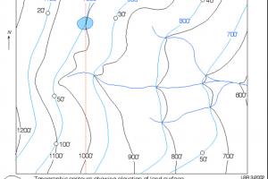
There are several different ways to show groundwater contours. Have a look at the URLs below for a range of treatments.  Good luck with it. Mike

Depth to Groundwater map - Tucson AZ    https://www.tucsonaz.gov/water/groundwater-maps 

Groundwater elevation map - Tucson AZ    same URL

Topo-Groundwater Contour Map  - http://www.gly.uga.edu/railsback/1121GWMap3.jpeg  

               This site is designed for students and some excellent graphics:  http://www.gly.uga.edu/railsback/GeologicalDiagrams2.html See the groundwater section.

Topo-Groundwater Contour Map

How can you tell an erosional gully from an earth fissure?

How can you differentiate an  earth  fissure from damage due to being  in  a flood zone?

AZGS Answer

Hi Kaitline,
Good question. Earth fissures tend to be curvilinear and frequently cut across drainages and erosional features. Also, a gully floor typically is graded downslope; fissures frequently are not so well graded and include local depressions where water pools. Have a look at some of our fissure pictures at our AZGS photo gallery (http://azgs.arizona.edu/azgs-photo-tags/earth-fissure)

I can't tell from your image, but it does look like a local erosional feature, which tend to follow local drainages. Let me know if I can help further.

All mapped earth fissures in Arizona are displayed at the Natural Hazards in Arizona Viewer. Check it out at: http://uagis.maps.arcgis.com/apps/webappviewer/index.html?id=98729f76e46...

Mike

Value of fossil-bearing limestones?

I found these rocks with what appears to be sea shell fossils while digging in my yard. They were at a depth of two feet. Are they rare and what should I do with them?

thanks Glen.

AZGS Answer

Glenn, They look like stream-rounded fossil-bearing (fossiliferous) limestones. These sorts of rocks are pretty common in the western and Midwest U.S. and elsewhere in the world. They are attractive but I don't believe they have any economic value.

Mike

Problem soils, help!

The ground outside my home has a number of small depressions. I've filled several with dirt and they continue to recur.

AZGS Answer

We have had a number of calls and e-mail about small depressions (measured in inches or tens of inches) in Phoenix, Tucson and elsewhere in Arizona. 

For the most part these are probably minor problems associated with local 'collapsing soils' where the soil is not well compacted. Small voids may exist in the shallow subsurface and over time the voids collapse resulting in localized collapse at the surface. This can happen in former agricultural lands as well.

Two things to do:

1) See our Down-To-Earth booklet: A Home Buyer's Guide to Geologic Hazards in Arizona pages 11 – 15 on problem soils.

2) Contact your local Natural Resources Conservation Service office - a federal agency that specializes in soils.

> In Phoenix: 230 N. First Avenue, Suite 509  ( (602) 280-8808 )

> In Tucson: NRCS - 2000 E Allen Rd, Tucson, AZ 85719 ( 520.670.6602 )

Good luck with it.

Mike

Hunting minerals near Payson, Arizona

What type of minerals are available to the public for collecting and where do I find any near Payson Az? Denise

AZGS Answer

Hi Denise,

On Federal lands, BLM, US Forest Service, you can collect any and all minerals. There are some limitation on collecting fossils and you would need to contact BLM about that.

Arizona State Trust Lands are off limits to collecting unless you have a permit.

Payson is surrounded by the Tonto National Forest, so there are plenty of places to hunt for minerals. For details of land management status, see AZ State Land Dept http://gis.azland.gov/webapps/parcel/ . Be sure to turn on the Land Ownership layer.

The interactive Geologic Map of Arizona can provide basic information on the rocks and minerals in the Payson area; I captured a snippet of the map below.    http://data.azgs.az.gov/geologic-map-of-arizona/#


What made you want to be a geologist

Hi! My name is Nicholas. I am currently going to Middle School in Glendale AZ. I am doing a powerpoint on geologists and I had a couple of questions that I would like to be answered.

1. What age did you become a geologist?

2. What made you interested in geology?

3. What is your favorite part about geology?

4. What has been your favorite discovery (if any?) 5. What is your favorite mineral?

AZGS Answer

Hi Nicholas,

Happy to help:

1. What age did you become a geologist?  27 years old

2. What made you interested in geology?  I really enjoyed the physical processes, such as volcanism, that impact and sculpt the Earth's surface.

3. What is your favorite part about geology? Physical volcanology and talking to people about geologic features and processes.

4. What has been your favorite discovery (if any?)  Some work I did published on the frequency of cinder cone emplacement in Arizona's San Francisco volcanic field.

5. What is your favorite mineral? That a tough call. I like hornblende, plagioclase (anorthoclase) and tourmaline.

Can quartz encase rock?

I found a rock in Tucson Arizona that looks like it is encased in Quartz?  Have you heard of this before? thanks! Lisa


AZGS Answer

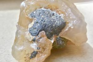
Lisa, It certainly appears to be crystalline rose quartz attached to a volcanic basalt or andesite cobble. Secondary minerals, like the rose quartz, form as silica-rich, oversaturated fluids, move through existing fractures in rocks. When conditions are right (temperature, pressure, and fluid chemistry) the oversaturated silica plates out onto the surrounding rock.

This is a great example of that. Thanks for sharing the image.

Mike

Rose quartz on volcanic rock

Reports on historic clay mining in Arizona?

I  can't seem to find any information about historic clay mining around the Phoenix area. I would love to read about it. Any suggestions on books or online information? Thank you for any help you can give me! Thanks, Vanessa

AZGS Answer

Vanessa,

Great question and not an easy one. Most historic mining reports focus on copper, gold, silver ... Clay goes largely overlooked. Here are some online resources that include discussions on clays in AZ.

Industrial Minerals (includes statewide map showing clay mining? distribution in AZ - p 12-13) http://repository.azgs.az.gov/uri_gin/azgs/dlio/1600

Geology & Mineral Resources of AZ (part v, p. 324) http://repository.azgs.az.gov/sites/default/files/dlio/files/nid1005/bulletin-180_part5.pdf

There is said to an excellent source of pottery clay near Kingman, AZ. You might try the local Chamber of Commerce there.

If you are interested in soils, which frequently include clays, the University of Arizona Press 'Arizona Soils' is online at:

http://www.library.arizona.edu/exhibits/swetc/azso/

For a report on Horseshoe Dam clay in Maricopa County: http://docs.azgs.az.gov/OnlineAccessMineFiles/G-L/HorseshoeDamClayMarico...

I hope this helps.

Mike

Is there ore in this rock?

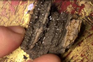
I recently found a chunk of rock while walking around and I can't figure out what it is. Would you mind helping out with the identification of it please? It kind of looks like pumice but it greyish in color with goldish or copper color metallic flakes and white and yellow banding on part of it. Carl


AZGS Answer

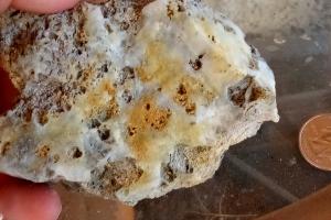
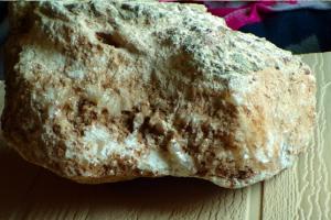
Hi Carl, Thanks for the pictures, one of which is shown here.

The whitish to opaline material looks like a secondary silica gel that commonly occurs in hydrothermal environments where silica (SiO2) is saturated in the liquid phase, causing it to precipitate on a host rock. Take the blade of a pocket knife and drag it across the white material. If the knife blade leaves a metal gray streak it is softer than the white material. That would be characteristic of a silica gel, which has a hardness of seven, like’s its crystalline relative quartz. Unfortunately, magnifying the images just cause them to blur. I’m hard put to describe the rock minerals. I do suspect that this rock occurred in an area of highly altered rock, perhaps associated with copper ore. I can barely make out platy looking minerals. If they are really platy, again try the knife blade, if they are soft and flaky they are probably a form of mica – muscovite (silvery) or (biotite); there are other micas as well. If instead of being platy they are rectangular prisms, they are probably altered pyrite. I hope this helps. Mike

Is there ore in this rock?

I recently found a chunk of rock while walking around and I can't figure out what it is. Would you mind helping out with the identification of it please? It kind of looks like pumice but it greyish in color with goldish or copper color metallic flakes and white and yellow banding on part of it. Carl


AZGS Answer

Hi Carl, Thanks for the pictures, one of which is shown here.

The whitish to opaline material looks like a secondary silica gel that commonly occurs in hydrothermal environments where silica (SiO2) is saturated in the liquid phase, causing it to precipitate on a host rock. Take the blade of a pocket knife and drag it across the white material. If the knife blade leaves a metal gray streak it is softer than the white material. That would be characteristic of a silica gel, which has a hardness of seven, like’s its crystalline relative quartz.

Unfortunately, magnifying the images just cause them to blur. I’m hard put to describe the rock minerals. I do suspect that this rock occurred in an area of highly altered rock, perhaps associated with copper ore.

I can barely make out platy looking minerals. If they are really platy, again try the knife blade, if they are soft and flaky they are probably a form of mica – muscovite (silvery) or (biotite); there are other micas as well. If instead of being platy they are rectangular prisms, they are probably altered pyrite.

I hope this helps.
Mike

Hydrothermally altered rock

What are these square crystals?

Hello I have been trying to figure out what this rock i found is or what mineral it is displaying ever since it was found up in Peeples valley. I have pics but i dont see anywhere to post them. its a creme/beige  color with different layers showing and all over it are these perfect squares with smaller and smaller squares inside each one all the way down to basically a dot. the outter most square is probably 3/8'''-1/2'' in size and u can see partial squares coming out from the lower layers partially covered by the upper layers. i hope that is a good enough explanation, if not i can send pics to you. thanks for any help you can provide.


AZGS Answer

Jerry, great pictures. It appears to be an igneous rock containing crystals of pyrite, iron sulfide (FeS2). The box-within-box appearance suggests that these are zoned pyrites. I wish I could be more certain of my analysis, but this is the best I can do with pictures. The thin, nearly parallel bands of iron staining are referred to as Liesegang banding”, representing precipitation lines of iron-rich minerals (e.g., hematite, limonite, goethite, etc.).

Cool rock.

Mike

,

Gold flakes or weathered biotite

Hello, I live in The Valley in California and in my basement the ground is covered with gold flakes the dirt is everywhere and even inside the chimney there's like gold sandstone flakes in it.  How can I tell if it's real gold or not or if I'm just digging up fools gold because the ground is got alot of gold in it. Jessica

AZGS Answer

Jessica,

A more likely candidate is biotite.  Biotite is a common platy mineral that when oxidized takes on a gold sheen. Try scratching one gently with your fingernail. Biotite is very soft and platy. You should have no trouble scratching or leaving an indentation.

If you want to take some high quality pics and send them to me, I'll eyeball them.

Mike

Rocks of Williams, Arizona

What types of rocks and minerals are common in Williams, AZ?

AZGS Answer

Williams, Arizona, is on the western-most edge of the San Francisco volcanic field. The rocks exposed near Williams are predominantly basalts with small phenocrysts (minerals) of olivine, pyroxene and plagioclase. You won't find the large olivine (peridot) crystals that are found in the San Carlos volcanic field of central Arizona.

The Bill Williams Mountain volcanic complex comprises a suite of coalescing andesitic to dacitic lava flows and volcanic domes emplaced about 3.5 million years ago on the southwestern edge of the San Francisco volcanic field, east of Flagstaff, Arizona. I don't have in front of me a description of Bill Williams Mtn. rocks, but andesites and dacites typically include: plagioclase feldspar, pyroxene, hornblende, biotite, and quartz.

Photo by Ted Grussing. The town of Williams is left of BWM. On the horizon, from right to left, are four younger volcanic vents: Mount Elden, the San Francisco Peaks (including Humphreys Peak the highest point in Arizona at 12,637’), Kendrick Peak and Sitgreaves Mountain.

Thanks for your question.

Mike

Where can I find groundwater data for Marana, AZ?

Good day,

I would like to see a map that shows the aquifer (aquifers) in Marana, Arizona (Twin Peaks Road and I-10 area). I was told by a geologist that there is a geological barrier that prevents water coming from Marana (I think the Santa Cruz River) to enter this aquifer. It is only rain water that is replenishing it. Please identify this barrier on the map you send me. Marana now has three wells taking water from this area. Several of our residents( Blue Bonnet Road/Oasis Road area) have had to deepen their wells. Two Marana city wells  are on either side of the I-10 Freeway at Twin Peaks Road and the third well is on West Tangerine (I was told this well is not giving much water). Marana officials are telling me that CAP water is able to replenish the water removed by their wells. In addition to the map that shows the barrier; would you please confirm to me in writing that water can or cannot enter this aquifer from Marana. Please explain in detail so I can understand thi  s better. New Arizona laws require that any new housing subdivisions have access to 100 years of renewable water (Marana has at least six or seven approved new subdivisions along the Twin Peaks corridor). I need to know that the current residents on Blue Bonnet Road/Oasis Road will continue to have water or are the city wells removing water from this area without replenishing it. Your help in understanding this situation is greatly appreciated. Gayle

AZGS Answer

Gayle,

All fine questions, but a better source would be the Arizona Dept. of Water Resources (ADWR).  Your area of interest is encompassed by their "Tucson Active Management Area", which includes Marana and extends NW to Picacho Peak and Picacho Mountains.

ADWR has more than 800 monitoring wells in Arizona that provide information on water quality and groundwater levels. They use satellite InSAR imagery to track ground subsidence in areas where groundwater withdrawal is particularly high.

Regarding CAP water and recharge of existing aquifers, you’ll need to either address that with ADWR or CAP folks

Sorry I can’t be more help. We do engage in basin analysis studies, but more from the basin geometry and structural side than groundwater side of the equation.

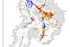
This image illustrated the groundwater conditions in the Tucson AMA. You can download the entire 71p report on Tucson AMA at http://www.azwater.gov/azdwr/StatewidePlanning/WaterAtlas/ActiveManagementAreas/documents/Volume_8_TUC_final.pdf

Mike Conway, Arizona Geological Survey

Groundwater conditions in Tucson and environs

Origin of boulders in Indian Gardens, Oak Creek, Sedona, AZ

Good afternoon,
I am a writer working on novel (Sedona is my hometown), and I'm doing some research on Oak Creek Canyon. I've been reading your very helpful "A Guide to the Geology of the Sedona & Oak Creek Canyon Area, Arizona"; thank you for this resource. However, I'm trying to determine what type of rocks/boulders lie in the bed of Oak Creek. I'm thinking in particular of the rocks in the Indian Gardens area--the large rounded grey stones scattered along the creek bed. Is this basalt talus as described in the guide or from a different source? Thank you very  much for your time and any help you can offer.
Sincerely, Bryn C.


AZGS Answer

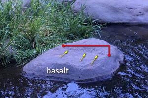
Hi Bryn, Nice pics. Because the boulders are worn and sculpted by running water, it’s a little hard to be certain. But I've annotated a boulder that possesses a vesicle pipe – outlined in red and pointed to using yellow arrows - that is almost certainly from a basalt lava flow.  As the flow cools, gases tend to congregate in pipes as they migrate upward, or sometimes laterally in the flow.

 I would not be surprised if the majority of boulders here were derived from basalt lava flows situated on the Mogollon Rim.

Mike Conway


Basalt boulder at Indian Gardens, Oak Creek, Arizona

What do geologists know about geopathic stress

Is geopathic stress,  earth energies understood  and accepted  by geologists? Robin

AZGS Answer

Hi Robin,

You caught me out of my comfort zone. I had to look up geopathic stress. If I understand correctly, it is the study of earth energies (magnetic, gravitational?) and their effect on human well-being. I've never encountered that concept in the geologic literature. It does appear in some health literature, however.

Nonetheless, there seems to be no evidence that geopathic stress is a true physical phenomenon.

Thanks for a challenging question.


How do horsts form?

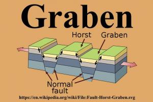
SO, a block of earth's crust between two parallel faults drops or subsides, becoming a basin, or graben, in the Basin and Range Province of the American West. For me, it's relatively easy to understand how tectonic forces, especially with the aid of gravity, can cause a block of crust to "sink," thereby becoming a basin. But what force is it that causes the adjacent block of crust to RISE, thereby becoming a mountain range, or horst? I pretty much understand the half-graben, which involves only ONE block of crust that is rotated, or tilted, with one side of it dropping down while the other side is, naturally, tilted up ... the "sunken" side becomes the basin, or valley, while the side that is tilted up becomes the mountain range. But my question concerns the scenario where TWO blocks of crust are involved with NO tilting -- in classic horst and graben topography, how does the horst (a complete block of crust) rise? What force is exerted on that single block of crust that causes it to uplift and become a horst? Many thanks.

Steve

AZGS Answer

Steve, Good question that goes directly to the heart of the mechanics of horst and graben formation.
Have a look at the illustration below. The red arrows at the end of the block represent the local stresses, which are extensional. So the crust is being pulled apart. The rocks of Earth's crust accommodates extension by breaking into discreet blocks along planes of weakness - faults.
With extension, alternating blocks (graben) physically subside while the intervening blocks remain in place, but are now relatively higher than the grabens. Arrows along the faults illustrate the 'relative' motion of the block, not the absolute motion. So the fault plane arrow shows the horst being uplifted 'relative' to the downdropped graben.

I hope this explains it.
Mike


Horst and graben

Climate change/drought impacting groundwater supply?

Do you know of anyone or any recent study that has looked at impacts of climate change/drought on groundwater supply volumes in Arizona?

Thank you!

Kim

AZGS Answer

The answer is undoubtedly yes, although the effects of climate change on groundwater resources might be difficult to tease out of the data.  

1) Groundwater recharge & climate change in the west - https://uanews.arizona.edu/story/groundwater-recharge-and-climate-change....
2) Modeling climate change impacts - and uncertainty - on the hydrology of a riparian system: San Pedro Basin (Arizona/Sonora) https://www.sciencedirect.com/science/article/pii/S0022169407004799.

For decades, farmers in central and southern Arizona have drawn on groundwater to irrigate their crops. As a result, groundwater levels of some aquifers in southeastern Arizona have dropped hundreds of feet. This rate of groundwater level fall far outstrips the effects of climate change or drought on groundwater recharge.

By way of example, drawdown of the Ogallala aquifer, situated east of the Front Range of the Rocky Mountains, has reduced groundwater volume such that hydrologists estimate that it would take as much as 15,000 years of 'average' annual rainfall to bring it back to levels observed in the early part of the 20th century. So while climate change and drought can undoubtedly impact groundwater levels, that signal is swamped by drawdown of the aquifer for farming and industry.

Check out the USGS National Water Information System (https://nwis.waterdata.usgs.gov/nwis)  for vetted data on groundwater levels and conditions in Arizona. The Arizona Dept of Water Resources (https://gisweb.azwater.gov/waterresourcedata/) would be another good resource for you.

I hope this helps.
Mike


What is going on with these rocks?

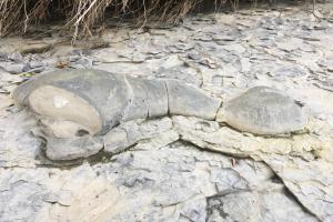
 Hi.  I live in Upstate NY near a small creek.  The creek is mostly shale.  As the shale erodes other rocks become visible that are round and curvy.  They range in size from the size of a basketball to larger.  Some are dome shaped with a dimple on them, others are long and curvy like they were mud or cement mix poured onto the shale as it was forming.  I've never seen rocks like this before.  If needed I do have pictures I could email you.  I was wondering what these were called and how they were formed.  Can you help me with this? Thanks, Clint

AZGS Answer

Hi Clint, They look very much like concretions. I did a quick internet search and ran across a manuscript describing the Devonian Hamilton Formation of NY, PA, OH, VA. The Hamilton Formation outcrops in the Cayuga Creek area. Apparently, concretions – of all shapes and sizes – are common in the Hamilton. At one time, some concretions were mistaken for ‘petrified tortoises’.
 
Concretions form as fine-grained calcium carbonate sediments coagulate around some object; a fossil fragment, rock …
 
I hope this helps.

Mike


,

Origin of glassy rock?

Hi, Can you tell what this is why it appears so odd?

AZGS Answer

Hello Harness,

This specimen looks very much like silica froth that accompanies the eruption of silica-rich magma. For example, obsidian. The obsidian dome in Long Valley, California, is coated with this type of material.

Compositionally, it is comparable to rhyolite - a volcanic rock, but textually, it is a volcanic glass (pumice) that forms as gas - mostly H2O and CO2 escape from the depressurized magma.

Cool stuff. Where did you say you found it?

Mike


Missing corner quarter section marker - what to do?

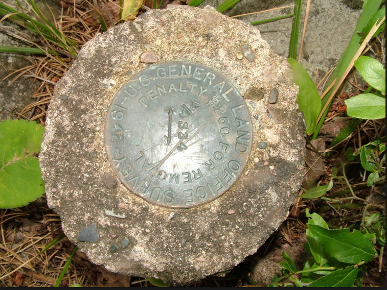
This is not a question about geology, but about State Geological Survey markers. To whom do 1/4 section markers belong ? I ask because the one which used to be at one corner of our property has been removed by someone and I am wondering who to report this to and if it can be replaced. Perhaps you can refer me to the proper agency? Betty

AZGS Answer

Hello Betty,

I visited the Public Land Survey System page and they note the existence of monuments at quarter-section corners. I guess if you were reporting a missing or stolen monument, the Bureau of Land Management would be the place to start.

The Arizona BLM office in Phoenix, phone # 602.417.9200.

Good luck

Quarter section marker

What & where are the oldest rocks in Arizona

What is the oldest exposed rock in Arizona?  How old is it?  And what geologic formation is it in?  John


AZGS Answer

John,

The oldest rocks in Arizona are the Vishnu Basement Rocks exposed in the Upper Granite Gorge, Grand Canyon. The Brahma Schist, part of these basement rocks, are about 1.75 billion years old. Locally the Brahma is interlayered with Rama Schist Xr and Vishnu Schist (Xv).

There are some similarly aged rocks in the Prescott area.

Brahma Schist consists of amphibolite, hornblende-biotite-plagioclase schist, biotiteplagioclase schist, orthoamphibole-bearing schist and gneiss, and metamorphosed sulfide deposits.

Mike Conway


Tracking down mineral rights

My mother, Mary Backus, passed away on February 8 , 2018.  She was born In Douglas, AZ in 1920. Her father, Murray Patterson and his uncle Oliver Patterson both homsteaded land in Apache, AZ. In 1928, they moved to Mesa, AZ. My mom has talked about how her family still owns the mineral rights of the property where they lived. They had a very large ranch and a small Adobe home.  Since she passed away my brother has been working on getting her estate in order. He has not found any paperwork about these mineral rights. Is there an agency we can contact to see if she still has these mineral rights?  
Thank you,
Nancy

Submitted on Tuesday, June 26, 2018

AZGS Answer

Hi Nancy,

This might be a tough problem to solve. I suggest starting with the Cochise County Assessor. I doubt that your search will end there, but if you know the precise location of the property that is a good place to start.  You can view the Cochise County Assessor page at https://www.cochise.az.gov/assessor/home. You might pursue the issue with the Cochise County Recorder, too. ( https://www.cochise.az.gov/recorder/home)

Second, you might reach out to the Bureau of Land Management for information on the land management status of the land. If the federal government was ever involved, BLM would/should have records of any transactions. You can reach them by phone at 602.417.9200. You will need a precise location of the land or the landowners name to pursue this with BLM.

Good luck with your hunt.

Mike

Heat impact on magnets

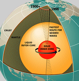
Question: Is it true that heat  demagnetizes magnets?  I don't understand how the earth's core can be magnetized if it is so hot.   And, how is the core solid if it is so hot.  Shouldn't it be a liquid?  Thank you.

AZGS Answer

Heat can damage or reduce the magnetization of bar magnets. As you heat a magnet the atoms move more rapidly and randomly disrupting the magnetic domains.

The Earth's core - a region of iron alloys - consists of a liquid outer core and a solid inner core. Earth's geomagnetic field stems from moving currents in the liquid outer core. The geomagnetic strengthens and wanes and reverses direction.

This model shows the physical relationship between the solid inner core and the liquid outer core. The enormous pressure on the inner core prevents it from becoming a liquid.Model of Earth's core.

Where can I find potting clay in Arizona Contd.

AZGS Answer

Paula: Check out the link below. It stems from Bulletin 180 and it contains a section on clays with a short note on pg 332 describing pottery clays in Arizona.  http://repository.azgs.az.gov/sites/default/files/dlio/files/nid1005/bul...

I hope this helps.
Mike


Where can I find clay for potting?

I'm a retired geologist originally from New York, now a full time potter living in Peoria, AZ.  I'm interested in collecting clay in the field, mostly for use in glazes.  Are there any resources (maps, organizations, active mines, websites, etc) that might give me some leads.  Thanks!

AZGS Answer

Great question. Let me do some digging and see what I can come up with. Mike

Injection well data for Arizona

Good morning,

Does your website provide a statewide list of Arizona underground injection control wells? If so, how can I find it?

Thanks for the info! Sarah

AZGS Answer

Sarah, We do not collect that sort of information.

I suggest that you contact:

Arizona Dept of Water Resources; or Arizona Dept of Environmental quality

One or both should be able to help.

Mike

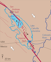
The geometry of the southern San Andreas fault

: Is it possible that the malleability of the Brawley Spreading Zone hides the continuation of the San Andreas to the Imperial Fault? Glenn

AZGS Answer

Hi Glenn,

The San Andreas fault system includes the Imperial Fault, south of the Salton Sea. The fault system bends near the Salton Sea resulting in extensional stresses (pull-apart) in the southern end of the Salton Trough (Sea).  Further south in the Gulf of California, the San Andreas system transforms into a spreading center. (That is not shown on this illustration.)Simplifed geologic map showing the southern San Andreas Fault system.


Pegmatites near Phoenix, Arizona

I am very interested in the mineralogy of pegmatites. I live in the northwest valley. Coukd you please tell me, where would the closest pegmatite be, that I could study? Peter

AZGS Answer

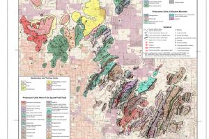
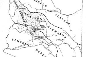
Peter, Decades ago, Richard Jahns, published a bulletin on pegmatites of the White Picacho District northwest of the Phoenix Basin. The map below shows his 'Arizona Pegmatite Belt'. That phrase did not find favor with geologists and has fallen out of use. But he did identify a number of pegmatite deposits.

You might also look at Ken Phillips short paper on beryl, which commonly occurs in some pegmatites. He includes a coarse map showing beryl location in central an northwestern Arizona.

The third edition of 'Mineralogy of Arizona' might be a good place to start your search.  The book is still in press or you might find it at your library.

Jahns (1952) http://repository.azgs.az.gov/uri_gin/azgs/dlio/84

Phillips (1986) http://repository.azgs.az.gov/uri_gin/azgs/dlio/1607

Good luck with your study.
Mike


Arizona Pegmatite belt

How does magma (molten rock) form?

Question: Despite doing some research, I still don't fully understand where lava and magma come from or how it's formed. Is magma or molten rock to be found everywhere on Earth below a certain depth and only forms lava or volcanos where cracks puncture the surface? Or does some kind of super heated pressurized material turn into magma when it's pushed up through the mantle? Is magma everywhere or only formed under specific conditions near the surface? I've never been able to get this question satisfactorily answered. I hope you can help.  Antonio

AZGS Answer

Antonio,
Good question! It has taken a lot of scientific brain power to answer the question of 'how does magma form'. The manner in which we use the terms magma and lava can be confusing; molten rock is referred to as magma when in the Earth's crust or mantle; and as lava when exposed on the Earth's surface.

The melting temperature of rocks in the upper part of Earth's mantle, where most magma forms,  is in the neighborhood of 1,100 Celsius.  So you either have to bring the temperature in the upper mantle to that level; or, you reduce the pressure - which promotes melting; or, you add water which acts as a flux to lower the melting temperature of the rock.

The lower crust and mantle include radiogenic elements such as potassium, uranium, thorium. Radiogenic decay of these elements releases heat. When added to the primordial heat of Earth's formation, the temperature is sufficient to melt small quantities of upper mantle rock.

Adding water to the mix, which occurs along zones of subduction - where oceanic crust sinks back into the mantle - increases the likelihood of melting. Water acts as a flux, lowering the melting temperature of the rock. The volcanic chain referred to as the 'Ring of Fire' forms adjacent to subduction zones as a result of water released from the sinking oceanic crust being introduced into the mantle and inducing melting. Molten rock, i.e., magma, is less dense and more buoyant than the surrounding rock, as a result magma rises through Earth's crust. Most magma is trapped in the crust, but some erupts onto the Earth's surface as lava. 

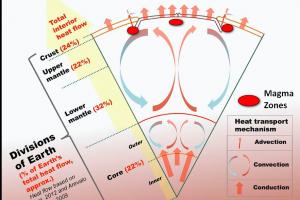
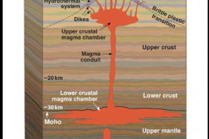
There, I've synthesized 100 years+ of geologic studies of magma formation into 4 short paragraphs. The attached image shows the likely zones of melting of mantle rock.

I hope this helps. MC


Heat circulation in Earth's interior

Mineral prospecting in Maricopa and Yavapai Counties

Hello, I'm interested in doing some modest prospecting for metals in Maricopa and Yavapai Counties. Can you help with information on metallic mining districts in the two counties?  Will

AZGS Answer

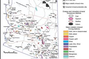
Will, We can indeed provide information on metallic mining districts in the two counties, and for that matter all of Arizona. But first, a word of warning: you need to recognize that mining claims may already exist for areas previously mined and for lands that may show no evidence of mining. For private lands, you would require the owners permission. For federal lands, check with the Bureau of Land Management in Arizona for current mining claims. For state lands, please get with the Mineral Management program of the Arizona State Land Dept. regarding mining claims and prospecting.

Over the years, the Arizona Geological Survey and its predecessor agencies have published dozens of reports on mineral resources of Arizona.

  • Gold Placers and placering in Arizona   
  • Gold Prospering – links to 8 publications
  • Geology and Mineral Resources of Arizona 6-parts ~350 p.
  • Mine Index for metallic mineral districts of AZ
  • Metallic mineral districts & production in Arizona w statewide map

This is by no means everything we possess on mineral resources, but it is a good start. All of our publications from 1915 to 2018 can be discovered and downloaded free of charge from our AZGS Document Repository. 

Metallic mineral districts in Arizona

What sort of rock is this?

I have a question about a crystal please write back so I can send the video I need you to tell me what type of crystal this is. Jeremy

Ed. note: see picture captured from video below.

AZGS Answer

Jeremy, I suspect it is a fragment of petrified wood that hosts some larger, granular crystallization. I can’t be sure based on the video, but I think the coarser materials are crystals of quartz. (Quartz or silica is frequently involved in the petrification process.)
Thanks for the question. MC


Petrified wood(?) with coarse quartz crystals

Colors of chert

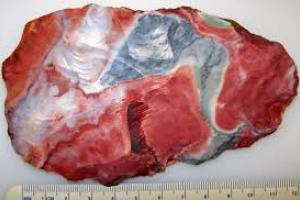
Hello, I have heard that Buffalo River chert, when freshly broke is a reddish color, but after being in the ground for a thousand years, it will patina to a pinkish color? Your thoughts? Thanks , Jeff

AZGS Answer

Hi Jeff, Chert is a really fine-grained sedimentary rock made up of microcrystalline silica. It is very hard, brittle, chemically stable. The color of chert varies greatly. Red coloration is the result of small amounts of iron that finds its way into the crystal lattice during formation.  

I don't think that sitting in the ground for 1000s or even million of years will have much impact on the interior makeup or color of chert. It's chemically inert. You might see some discoloration on the outer perimeter, probably due to post deposition oxidation of the host rock.

I hope this helps and thanks for a great question.

MC

Red chert - microcrystalline silica

Should I be worried about expansive soils?

Hi, I'm looking at purchasing a home in Chandler, Arizona, and I would like to avoid the problems that accompany expansive soils. Am I safe in Chandler. Sean

AZGS Answer

Hi Sean. Expansive soils are clay-rich soils that expand when wet and shrink when they dry out. They are frequently called shrink-swell soils and they are common in many places in the U.S. including Arizona.

Investigating and characterizing soils is outside the scope of the mission of the Arizona Geological Survey. But we do know where you can go for soil information, the Natural Resources Conservation Service (NRCS) of the U.S. Dept of Agriculture. The NRCS has an office in Phoenix and can be reached at 602-280-8826. Their web services are located here: https://www.nrcs.usda.gov/wps/portal/nrcs/surveylist/soils/survey/state/?stateId=AZ

NRCS provides a marvelous online soil mapping tool, Web Soil Survey .

For more on problem soils, see our Down-To-Earth booklet: A Home Buyer's Guide to Geologic Hazards in Arizona; see pages 11 - 15.

NRCS Soil Survey, Southwestern U.S.

Water well data for Arizona

Hello. I am exploring the availability of online water well log databases for the USGS. I discovered AZGS was involved in compiling several state well log databases that ended up being distributed on data.gov. Unfortunately none of the state databases could be downloaded from their site. I either experienced a "can't find the web page" message, or the web page said the "link to the file is broken".  Could you ask around and determine if there a way for the USGS to obtain these datasets?

Thank you
Les Arihood


AZGS Answer

Les:

I believe that we can help. Here are well URLS for well data - Water & Oil & Gas

  • McGarvin, T.G. and Trapp, R.A., 1994, AZWELL: A digital database of the Arizona Geological Survey Well-Cuttings Repository.  )  Arizona Geological Survey Digital Information-2, 6-p report, 1 ASCII file.  
  • Scurlock, J.R., 1973, Arizona Well Information: Supplement 1. Arizona Bureau of Mines, Oil and Gas (OG)-26, 30 p  
  • Arizona Well Information - 1972  4 parts (pdf documents)  
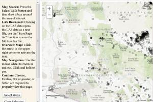
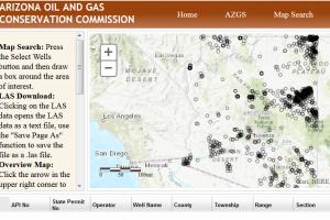
  • Interactive Arizona oil and gas well viewer (w geophysical logs and downloadable data).   http://welldata.azogcc.az.gov/

You might chat with the folks at the Arizona Dept. of Water Resources. They should have quite a bit more data in easily consumed digital form.
Mike


Arizona Oil and Gas viewer

Where in the world is Nyal Niemuth?

What happened to the Department of Mines & Minerals files & Nyal Niemuth? Doug

AZGS Answer

Doug, good questions.  The former died while the latter lives.

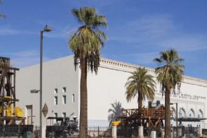
ADMMR went belly up in 2010-2011. The Brewer Admin shuttered the museum and handed off the mineral collection to the Arizona Historical Society. In 2016, the mineral collection and old museum (Polly Rosenbaum Building) were transferred to the Arizona Geological Survey. A year later, the collection and museum were transferred once again to Research, Discovery & Innovation team at the Univ of Arizona. Both collection and museum reside there today.

Nyal is alive and well and semi-retired in Phoenix, Arizona. After the demise of ADMMR, Nyal hired on with us at AZGS through June 2016, when he retire after 30+ years in service to the state of Arizona. In July 2016, AZGS was taken out of service as a state agency and transferred to the Univ of Arizona. We reside there today.

There you have it in a nutshell.

Mike Conway


Polly Rosenbaum Building, Phoenix, Arizona

What is this rock?

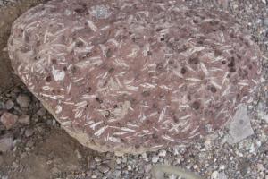
I recently went hiking in the Aravaipa area and saw several reddish-brown rocks with white "scratch" marks on them. The rocks were of various sizes ranging from palm-sized to the size of a loaf of bread. The entire surface of the rock was covered in small holes similar to pumice but with only a fraction of the holes. The "scratches" are in random directions and cover the entire rock. They are about 1/4 to 1/2 inch long. I am curious as to what would cause the white marks--they do not seem to be a different mineral within the rock. I have a picture I can send in if you would like it. Ric

AZGS Answer

Hello Nic,
This is a volcanic rock, probably an andesite or dacite. The white linear features are mineral crystals of the feldspar mineral family – the latter is a guess but I’m pretty confident. The small half-sphere indentations appear to be vesicles. They occur when gas – H20 mostly – escapes from the cooling lava.

This rock has porphyritic texture – larger mineral grains in a groundmass of finer grained minerals.

Thanks for sharing the image.
Mike


Porphyritic dacite or andesite

How do buried gravels get a black coating?

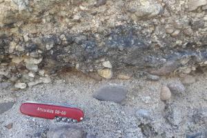
Good day,  I have a question regarding Pleistocene to Holocene river deposits.  Commonly along the Agua Fria and the Salt River channels, and about 20-50 ft below the surface elevation, exists cross-bedded, poorly sorted cobbles and pebbles with a distinct even black coating.  The black coating is not a weathering rind since it does not penetrate the surface.  It also seems to coat the entire cobble with no preference to orientation. I have a few interpretations such as preserved algae (but if true, I would expect a preferred orientation of the coating to be on the "top" of the cobble), desert varnish during a dried abandoned river bed event (but again - orientation is a problem), ground water contamination (but I might expect more of a rind in the cobbles and that elevation should be more consistently black), or an organic coating from decayed fauna or flora?  It seems that the latter of the options is most likely.  

Since I've noticed this at a distinct depth below surface and according to this source; http://azgs.az.gov/arizona_geology/summer09/article_sanpedro.html
"...the presence of orange or black coated pebbles and cobbles on Pleistocene-age surfaces is equally diagnostic". Are there any research papers available that further explain the diagenesis of black-coated cobbles of Pliocene to Holocene age?

Let me know if you'd like to see some pictures and I'll send them over. Thanks, Cameron


AZGS Answer

Cameron, My guess is that the black gravel coatings are mainly manganese and iron oxide concentrations. These compounds give desert varnish its brown or black color, but can also be deposited by groundwater. There are some nice examples in our Dome Rock Mtns SW quadrangle map (Jon Spencer and I led an AGS fieldtrip to this area in 11/15), where manganese and iron coatings exist on basal Bouse carbonate but also in gravel layers in old Colorado River deposits (Bullhead Alluvium) and tributary gravel deposits.

Contributed by Phil Pearthree, Arizona State Geologist; Photos by Brian Gootee, AZGS Research Scientist

Black desert varnish unevenly coating alluvial gravel , Black gravel layer from Colorado River alluvium near Bullhead City.

Flooding information for Phoenix Arizona

Good day; What is the chance of the North Phoenix area (xxxx Rose Garden) and xxxx Avenue in Chandler being affected simultaneously by flooding? Martin

AZGS Answer

Martin,
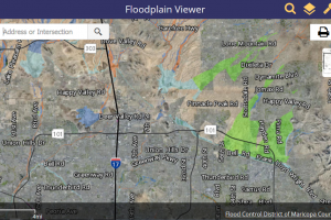
When I searched for xxxx Rose Garden., the Maricopa Floodplain Viewer brought me to Rose Garden Lane, north of the intersection of 101 and I17. If that is correct, that address is not included in the 100 year floodplain.  Thus, unlikely to flood.

The floodplain viewer could not find xxxx Ave., Chandler. Have a look for yourself. You can avail yourself of the Maricopa County Floodplain Viewer at
http://gis.maricopa.gov/floodplainviewer/

Good luck with it.

Mike


Maricopa County Floodplain Viewer interface

How does magma move from the mantle to the crust?

Dear Geologist:

My name is Ivan and I am in the fourth grade and I was watching a video of the Hawaii volcano eruption. And I was wondering how lava gets to the surface of the earth through the spout of the volcano and why magma is at the center of the earth and why is it hot? My tutor is typing this for me.

Thank you for your time.

Sincerely,
Ivan and Ms. Andrea


AZGS Answer

Hi Ivan, We know a lot about how magma - molten rock, forms - and we know a lot about volcanic eruption processes. But what we know is greatly outweighed by what we don't know.

For example, we know that magma's originate in the upper part of the Earth's mantle, not in the Earth's core. You are correct, the outer portion of the Earth's core is indeed liquid. But that molten material does not erupt onto Earth's surface.

We don't really understand the physics of how magma rises through the upper mantle and lower crust. The pressures are so great it's difficult to understand how vertical conduits capable of carrying tremendous volumes can open and remain open.

But it happens, so there must be a physical explanation, we simply have not discovered it yet.

So what causes rocks in the upper mantle to melt? A key factor is the concentration of radioactive elements. As those elements radioactively decay they produce heat. Couple that with heat resulting from great pressure and residual heat from the Earth's formation 4.5 billion years ago, add a little water - at subduction zones - and wa-la, magma. The density of magma is less than the surrounding rock - making it buoyant and capable of rising into the crust.  

Have a look at this cross section of Earth showing the crust, mantle and outer and inner core.

Good luck with your studies,
Mike


Magma conduit

Is there a single Arizona Mines database?

Is there a single digital database of mine locations, commodities, production, and status for Arizona? Jason

AZGS Answer

Hello Jason, There does exist a large database for mines in Arizona. It's hosted by the US Geological Survey as part of their Mineral Resources Data System. MRDS includes data for nearly 13,000 mines in Arizona. And bear in mind, that tens of thousands of undocumented mines - many no more than shallow exploration pits - exist in Arizona.

You can access and download these data from the USGS Mineral Resource Data System.

There are 45 fields in the database, including location - state, county, latitude & longitude - host rock, commodity, gangue minerals, ore geometry (if known) and more.

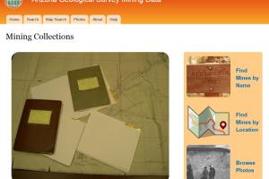
Another important source of mine data for Arizona mines is the AZGS Mining Data website. It comprises materials - reports, correspondence, assay results, drilling data, mine maps and geologic maps and 1000s of vintage photos of mines.

Good luck with your research.

Mike

Copper deposits in U.S. - USGS MRDS

Origin of healing dirt from Chimyo, New Mexico

Hello, What is the geological name for the  healing dirt in  Chimyo , NM. called? Mat

AZGS Answer

Mat, This is my first encounter with the healing dirt of Chimyo, New Mexico.

By one account, the dirt large consists sand-sized grains of minerals and small bits of rock. The addition of hydrochloric acid causes the material to fizz indicating a fair amount of calcite ( a common calcium carbonate). The pit from which the dirt is harvested is regularly refilled with fresh dirt by the church authorities.

This article seems authoritative, https://www.csicop.org/si/show/miracle_dirt_of_chimayo

Thanks for the question.
Mike


Chimyo, New Mexico - Healing dirt

Where can I hunt for minerals?

Hello, I'll be visiting Arizona soon and I would like to collect mineral specimens. My favorites are azurite and malachite, but I'm game for sulfides, silicates, sulfates and more. Barb

AZGS Answer

Hi Barb:

Collecting minerals is more difficult now than it was in the not-so-distant past. As frequently as not, tailing piles and mining dumps - once the cornerstone of mineral collecting - are no longer open to the public. There are a number of books on the topic and several common ones are bulleted below. Unfortunately, while the authors can point you to sites where minerals may be found, they can not assure you that collecting is permitted.

My advice: select some areas or sites of interest and then contact local rock hound or prospecting groups, historical museums and others regarding where you can legally scout for minerals.

Places you can collect moderate volumes of minerals or rocks include federal lands managed by the Bureau of Land Management; this includes US Forest Service lands. Check out Arizona-BLM 'Rock Hounding in Arizona' flyer for guidelines.

Places you cannot collect minerals or rocks, include: National Parks and Monuments, State Parks, Arizona State Trust Land, private lands (unless permission is provided), and Native American Reservations, among other places.

Recent books on Arizona Minerals

  • ‘Gem Trails of Arizona’, inexpensive, revised and re-released in 2010. The text identifies collecting sites, but buyer beware, I don't believe you can be assured of collecting.
  • Neil Bearce’s ‘Minerals of Arizona’ was an excellent text for collectors - now out of print. Note, much may have changed in site availability since it was published in 1999.
  • Anthony and others (1995) ‘Mineralogy of Arizona’ is the bible of mineral types and locations in Arizona. It does not, however, lean towards the individual collector.
  • Geology & Mineral Resources of Arizona (Bulletin 180) has details on mineral resources, but it was never intended to be a guide for collectors and it does not broach the subject of collecting minerals.

Good luck with it.
Mike


mineral stamp

Origin of black, magnetic rock found near T. Roosevelt Lake

I have a dark green to black extremely fine grained rock that is vey dense and heavy as well as magnetic.  The rock is basically smooth with small worn surface pitting and what appears to be fine score marks on the surface.  The score marks run at different angles across the rocks surface and do not appear to be mineral veins that go thru the rocks interior.
Found the rock in a stream bed around Roosevelt Lake, AZ.Any idea as to what it might be? Randy


AZGS Answer

Randy, That is a robust description. Magnetism occurs in terrestrial rocks, but it is not terribly common. You may have found a lodestone formed when magma intrude limestones. Unfortunately, I would need to handle the rock and do some physical test to be sure.  Try scratching the edge of white porcelain plate or coffee cup with the rock. If you see a black streak, the rock is rich in magnetite, a mineral that forms naturally on Earth. Good luck.

Information on the Blue Quetzal Mine

Good day, I'm pursuing information regarding the Blue Quetzal Mine in Mohave County, Arizona. Can you help? Bruce

AZGS Answer

Bruce: We host 400,000 unpublished pages of mine files for ~21,000 Arizona mines at our Arizona Geological Survey Mining Data website. You can search those files by: mine name, mineral commodity, keyword, or, importantly, location. The site includes a powerful geographic search tool. Additionally, you may find information regarding the mine in one our published Bulletins, Open-file Report, Contributed Reports, Contributed Maps, or Digital Geologic Map reports, all of which are available for free download through the Arizona Geological Survey's Document Repository. 

Good luck with your search.

Note: The mine name, Blue Quetzal, is an alias, we changed the name to protect the privacy of the inquirer.  (AZGS Staff)
Mining data, Arizona,

Where can I find data for oil & gas well

Good day, Where can I locate and access well logs for oil and gas wells drilled in Arizona? Paul

AZGS Answer

Paul, You should begin your search at the interactive Arizona Oil and Gas Viewer. The viewer comprises locations and data (well logs and geophysical logs) for more than 1,100 wells drilled for oil and gas in Arizona. The viewer was built by the Arizona Geological Survey, but is maintained and updated by the Arizona Dept of Environmental Quality, working under the guidance of the Arizona Oil and Gas Conservation Commission.

If you need assistance, please reach out to the ADEQ's oil and gas administrator at OGCC@azdeq.gov.

Arizona oil gas viewer

The geologic saga of Girl Scout Mtn., Casa Grande, AZ

I am an assistant principal in Casa Grande, AZ.  We are taking some students to Girl Scout Mountain which is on the southwestern edge of the Sacaton Mountains.  I will be talking to them about the formation of the mountains and identifying rocks.  From my research, I understand that the Sacaton Mountains were formed when the crust was stretched and thinned from the Pacific Plate moving in a northwestern direction.  At the same time, intrusive volcanic activity caused bulging in this area causing the domed rocks.  Through water/flood erosion, surface (sedimentary?) rocks eroded exposing the metamorphic and igneous rocks which intrusively formed.  My questions:  Is the water/flood erosion from the ice age melting?  What type of rocks would be prominent?  What caused all of the breaks in the exposed rock?  Anything else you could tell me about this area, is truly appreciated!  Many thanks! Dawn

AZGS Answer

Hi Dawn:  

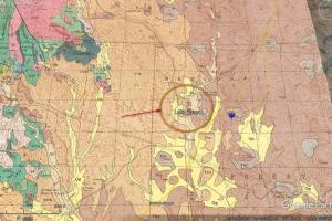
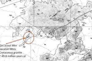
It just so happens that AZGS geologists Steve Skotnicki and Charles Ferguson mapped and reported on the Sacaton Mtn. geology in 1996. That report and the two maps that accompany it are online at http://repository.azgs.az.gov/uri_gin/azgs/dlio/415 .

But to address your question, the Sacaton Mtns formed as part of the Basin & Range extension which began about 30 million years ago and continues, albeit at a very slow rate, today. The Sacaton Peak Granite and other nearby granites, including Girl Scout Mtn (Kgk) are considerably older then the Sacaton Mtns. The granites were intruded into  Earth's crust between 49 and 63 million years ago. The Sacaton Mtns. as a geomorphic feature probably formed 20 to 10 million years ago – that is a ballpark figure.

Basin and Range uplift, i.e., mountain building,  certainly led to substantial erosional and exhumation of these intrusive granites. And precipitation and running water would played an important erosional role, removing and transporting sediments into the nearby basins.

The fractures in the granite, ‘joints’, are the result of the tectonic forces at work on the granite over the past 50 million years.  You will probably note that the exposed rock here appears to be somewhat rounded – half spheres. That is the result of chemical weathering of the feldspar minerals that dominate the mineral constituents of this rock and is referred to as spherical weathering – very typical of the way granites weather over time.

Glacial activity is almost certainly not important here.  
Let me know if I can help further.  Mike

P.s. A nice exercise for students is to provide color pencils or crayons and shade in the different units to get a better understanding of the relationship of the rock units. In this case, probably just Kgk and Kgq (the Sacaton Peak granite).

Sacaton Mtn geologic map with Girl Scout Mtn in orange circle.


Girl Scout Mountain, Casa Grande, Arizona

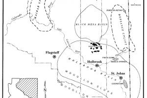
Geothermal and helium resources in Holbrook Basin, N Arizona

I had a question regarding geothermal potential specifically around the Holbrook area.  In my research, I found a map/study called "Geothermal Energy Resources of Arizona 1978" and it mentioned a "region of high chemical geothermometers" just south of the interstate and just west of the town of Holbrook.  Is there someone I can speak with about this?  I am in the helium exploration business and note anomalous high helium concentrations in a couple of wells just east of this "geothermometer" anomaly.  Any help would be greatly appreciated.  I have attached my email in the form above but would love to discuss over the telephone

AZGS Answer

Bo,

I’ll see what I can dig up on geothermal in Holbrook region.  There is currently one helium producer in the Holbrook Basin and a second company doing exploratory drilling.
Regarding helium there, have a look at:

  • Annual Oil, Gas and Helium production in Arizona: 1954-2009. 
  • Review of helium production and potential in Arizona Geological Survey
  • Coal, Oil, Natural Gas, Helium, and Uranium in Arizona

Good luck with the research.

MC


Helium in Arizona

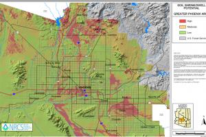
Soil problems in west Phoenix area

Hi, I live in the NW Phoenix area about 1 mile from the Agua Fria Wash. Over the past year, one of my neighbors has seen their yard go from a flat and featureless to pock-marked. What could be the cause? Shirley

AZGS Answer

Shirley, Your housing addition is situated on unconsolidated sediments shed off of the nearby Hieroglyphic Mtns to the north. In this setting, the sediments are loosely compacted and frequently rich in clay lenses that swell when wetted and shrink when dryed - shrink-swell soils. Placing a load on them or watering them frequently can result in local compaction and surface subsidence - i.e., potholes and larger irregular depressions.

We do have some resources at our website that describe the nature, impacts and distribution of swell-shrink or problem soils in Arizona. Also, have a look at our Home buyer's guide to geologic hazards in Arizona.


Shrink-Swell Soil map for Phoenix

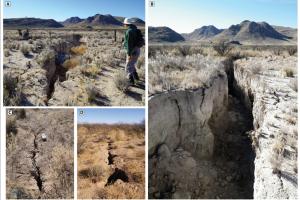
Fearful of earth fissures

  • Over the past decade, we have received dozens and dozens of calls and inquiries regarding earth fissures and how to mitigate them.

AZGS Answer

There is no simple solution to mitigating earth fissures. Multiple efforts have been made to backfill the Y-crack fissure in the Chandler Heights area with gravel, debris and concrete blocks. All those attempts have failed. Runoff from monsoon rainstorms frequently triggers fissure collapse and widening. Preventing water from washing into the fissure and eroding its sidewalls might successfully combat further widening and reactivation. The fissure, however, remains in-place in the subsurface.

For the location of all mapped fissure in central and southern Arizona, toggle the earth fissure theme at the Natural Hazards in Arizona viewer.

Other resources:

  • Earth fissures & Ground Subsidence
  • Home buyer's guide to geologic hazards
  • Why did the earth fissure cross the road?


earth fissure, cochise county, geologic hazard, subsidence

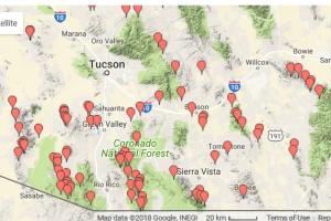
Primary mine & mineral resources for Arizona

Good day, Can you point me to primary sources of mine and mineral information for southeastern Arizona? Seth

AZGS Answer

Hello Seth: There is a lot of primary mine and mineral information available through the US Geological Survey and AZGS. First thing to do is review the information, publications and links that we host at the Minerals - Mining in Arizona section of our website.

For more granular data, I recommend these sites.

  • Arizona Geological Survey Mining Data - with files (reports, maps, correspondence, photos) for more than 20,000 AZ mines.
  • US Geological Survey Mineral Resources Data System - with reports on mines from all 50 states, including 1000s of mines in Arizona.

Good luck with the hunt.  MC


Mine, mineral, Arizona, Tucson

Can I use geothermal ground pump to heat & cool my home?

I'm interested in exploring geothermal energy as an alternative to heating and cooling my home. Is information on geothermal resources of Arizona readily available? Andrew

AZGS Answer

Hello Andrew: There are a lot of published resources for geothermal resources here in Arizona - see our Geothermal in Arizona page. It appears that you are looking for heat (ground) pump technology, which is frequently exploited to heat and cool homes, even here in Arizona.

  • Dept of Energy provides an excellent primer on heat pump technology for homes.
  • Ground-Source Geothermal Heating & Cooling in Arizona: A Case Study
  • Geothermal resources in Arizona (AZGS ~ 90 Open-File Reports)
  • National Geothermal Data System (More than 10 million data objects for all 50 states)

Good luck with the project. MC

Geothermal, heat pump technology

Purchasing printed copies of AZGS reports & maps

Good day, May I purchase a copy of Dave Briggs', 'History of the Verde Mining District, Jerome, Arizona? Paul

AZGS Answer

Hi Paul, Unfortunately, we no longer sell printed copies of any AZGS reports or geologic maps. We do, however, make them available for download at our AZGS Document Repository. No registration or account required. Dave Briggs 85-p paper on the United Verde Mining District is at  http://repository.azgs.az.gov/uri_gin/azgs/dlio/1877.

Thanks for the question. MC

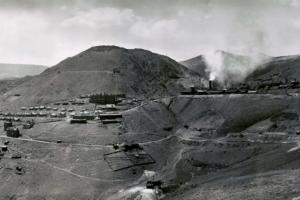
Panorama of Jerome c. 1900, Verde Mining District, United Verde pit mine, Jerome, Arizona (J.Rasmussen)

What are the characteristics of moonstone?

I have some specimens that I collected in NE Arizona on private property. They have been identified as gem quality Moonrock by a couple of local mineral dealers, but that was just upon visual examination. When I test the hardness, these samples seem to be more in the Corundum range at 9 on the Mohs. How can I identify this mineral definitively? Cal

AZGS Answer

Hi Cal,

I bet you are referring to moonstone, a feldspar comprising orthoclase and albite that is sometimes found in gem quality. (Moonrock refers to rocks derived from the Earth's moon.)

Characteristics of moonstone: Hardness of ~ 6.0, fracture uneven to conchoidal, opalescent, white streak on porcelain, and specific gravity of 2.61. Sometimes referred to as hecatolite. I hope this helps. MC

Arsenic in Arizona - what is the hazard level?

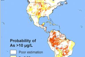
Arsenic is considered a natural hazard in Arizona according to your website. Do you have any recent documentation or contamination mapping for arsenic in AZ? Jennym

AZGS Answer

Hi Jenny,

That's a tough question to answer. I visited the Arizona Dept. of Environmental Quality website and queried 'arsenic'. I received 38 results. Here a link to those results - http://www.azdeq.gov/search/node/arsenic

Of course, the results are generally site specific. An exception is the 2016 Water Quality in Arizona 305(b) Assessment report, which includes water chemistry summaries for major river systems in Arizona.

Univ of Arizona's Water Resources Research Center (WRRC) has a recent piece on arsenic in groundwater, with some discussion of Arizona.

I wish I could be more help. Thanks for the question.

Arsenic in Groundwater map

Think you found a meteorite?

Do you think you have found a meteorite? AZGS

AZGS Answer

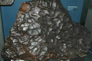
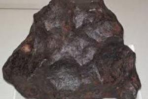
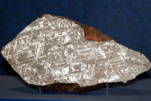
We receive lots of requests to confirm meteorite identification. In most cases the object is a terrestrial rock - basalt, lodestone, gabbro, hornblendite, or a piece of iron-rich slag. Most meteorites are strongly magnetic, there are exceptions, and, of course, there are terrestrial rocks with magnetic properties, e.g., lodestones, so the magnetic test is not in itself definitive.

Our friends at Geology.Com have cobbled together a short, illustrated write-up on how to identify meteorites and meteor-wrongs. You might start here.

Murnpeowie meteorite, Meteorite , Alvord Meteorite

Home Radon testing

I know that naturally occurring radon gas can constitute a health hazard. How do I go about testing the radon concentration in my home? M

AZGS Answer

Hi M.

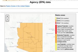
Radiogenic radon (222Rn) can constitute a health hazard. Here in Arizona, the radon concentration is moderate, ranging from 2 to 4 picoCuries/liter. Our Center for Natural Hazards has a page dedicated to the nature, distribution, and health hazards of Radon in Arizona.

The Arizona Bureau of Radiation Control provides a free radon home testing kit. To receive your kit e-mail them at radon@azdhs.gov and provide the following:  Name, Address, City, State, Zip Code.

Radon in Arizona (EPA), Radon test kit

Mineral-bearing rock from Globe, Arizona

I found this weird rock while I was out riding . It looks like a cluster of terminated Crystals , and when hit with a UV lite it glows purple, green and white. And some of the crystals look yellow. And when we found more of those rocks it had a smell of Sulfur. Brandi

AZGS Answer

Hi Brandi,

There is a lot of mineralization in the Globe area, hence all the mining and mines in the area. From what I can see some of the light-colored crystals may be the mineral fluorite. And fluorite, which shows a variety of colors - yellow, purple, white, lavender - will certainly fluoresce. Regarding the sulfur smell, I bet it is simply the earthy (light sulfur) smell commonly associated with mineral deposits.
Fluoride commonly associates with metallic sulfide minerals, such as galena, pyrite …


Fluorite-bearing rock, Globe, Arizona

Locating known Benchmarks - coordinates and elevations

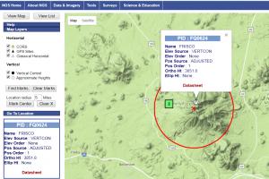
Can somebody list a few sets of coordinates with precise elevations for each set of coordinates?  I'm trying to test an elevation finder for accuracy. Shawn

AZGS Answer

Hi Shawn,

Try the National Geodetic Survey Data Explorer. They should provide coordinates and elevations of CORS sites (Continuously Operating Reference Stations) that meet your needs. https://www.ngs.noaa.gov/NGSDataExplorer/ .

National Geodetic Survey

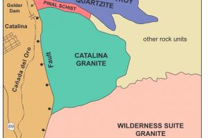
Name of common white speckled rock of Santa Catalina Mtns.

 I have seen a white rock use in landscaping (1 foot in diameter) and about the trails (as small as 1" in diameter) of Oro Valley, AZ near Pusch Ridge on the west side of The Catalina Mtns.  Of interest is that this white rock has many, many sparkles like glitter flakes all about it.  The glitter is like silver/white in color and the rock sparkles in the light.  Is this rock composed of granite?  I don't know what the name of the rock is or what is causing this glitter or sparkle.  Do you know.  I thank you in advance.  Thanks, Andy

AZGS Answer

Andy, I think you are probably referring to the Wilderness Suite Granite exposed along the western front of the Santa Catalina Mountains. Wilderness Suite Granite is a relatively coarse-grained igneous rock with quartz, feldspars (pinkish), and muscovite (small silvery minerals that reflect light and appear glittery. It is probably the latter mineral that catches your eye.

For our illustrated booklet on the western Santa Catalinas, download 'Guide to the Geology of Catalina State Park and the Western Santa Catalina Mountains'. I'm attaching a simple geologic map of the western Santa Catalina's showing the distribution of the Wilderness Suite Granite and other prominent rock units.

Santa Catalina Mountains

How can I determine if I own mineral rights on my property

 How can I find out if I own the mineral rightd to my properties in central AZ?  G

AZGS Answer

G, Establishing who owns the mineral rights to a piece of property can prove difficult.

Several things that I recommend:

  1. Download and review  Laws and Regulations: Mineral Rights in Arizona 9th edition.
  2. Contact your County recorder
  3. Contact federal and state agencies that track mining claims and mineral rights: US Bureau of Land Management - they have an office in the Phoenix area; Arizona State Land Dept, at the Government Mall in Phoenix.

Good luck.

MC

Mineral Rights in Arizona

Origin of Thumb Butte, Prescott, Arizona

How was thumb Butte in Prescott Arizona formed? I've heard it's from a volcanic plug but I've also heard speculation against that. Do you have any scientific opinions? Jenna

AZGS Answer

Hi Jenna:

According to Prof. Beth Boyd, Yavapai College, Thumb Butte is an outcrop of volcanic rock that formed about 14.8 million years ago.  That puts it in-place at the time of formation of the Hickey Formation, which comprises mostly basaltic lava flows and vent. Thumb Butte is made up of latite - a volcanic rock with alkali feldspar, plagioclase and a low volume of quartz. Thumb Butte looks like a volcanic neck, but there is evidence to suggest that it is simply a thick pile volcanic lava.

MC

Thumb Butte, Prescott Arizona

Naming a newly discovered mineral

My husband and I made a discovery of a new mineral and was wondering how to go about having it named. Penny

AZGS Answer

Penny, According to the Mineralogical Society of America, about 4,000 minerals have been identified, with 30 to 50 new minerals discovered each year. The International Mineral Association keeps a running list of minerals. 

Establishing a new, previously unidentified mineral is not a simple task and requires high precision microscopic analysis, geochemistry, and optical measurements.  Naming a new mineral requires addressing the the International Mineralogical Association – Commission on New Minerals, Nomenclature and Classification protocols. Have a look at their 'A new mineral! What to do? webpage.

I hope this helps.  MC


International Mineralogical Association logo

Mapping Holocene deposits on Salt and Gila Rivers

Do you have plans to expand your Holocene river mapping project to the Salt, Gila and Santa Cruz Rivers? Kay

AZGS Answer

Kay, Not at this time. Several years ago the Arizona Dept. of Water Resources contracted with us for mapping Holocene (past 10,000 years) deposits along the San Pedro and Verde Rivers and their major tributaries.

That work resulted in several geological products - maps and reports -  available for all to download at the AZGS Document Repository.

  • Mapping of Holocene River Alluvium along the San Pedro River, Aravaipa Creek, and Babocomari River, Southeastern Arizona: Arizona Geological Survey Digital Map - River Alluvium Map 01 (DM-RM-01), map scale 1:24,000.
  • Mapping of Holocene River Alluvium along the Verde River, Central Arizona, Arizona Geological Survey Digital Map - River Alluvium 02 (DM-RM-02), map scale 1:24,000.
  • Mapping of Holocene River Alluvium along Oak Creek, Wet Beaver Creek, West Clear Creek, Fossil Creek, and the East Verde River, Central Arizona: Arizona Geological Survey Digital Map - River Map 03 (DM-RM-03), map scale 1:24,000.
Holocene mapping of Oak Creek, central Arizona

What does the Basin & Range Province look like in cross section?

Does anyone have a generalized subsurface profile of the basin-range province, and specifically Arizona?  Curtis

AZGS Answer

Curtis, There are a number of generalized Basin & Range models that crop up during a google search. Bob Scarborough, formally of AZGS, published a suite of detailed Basin and Range cross sections in 1985. The 20+ cross sections and short report are available here, Geologic cross sections of western Arizona Basin and Range, with accompanying geologic maps and other information. You might start with Plate 4; plate 3 superposed the cross section lines on a map of Arizona. 

For a cross-section from the Baboquivari Mtns to the Transition Zone near Safford Basin, see Arca's Geologic map from the Baboquivari Mtns to the Transition Zone of the Colorado Plateau.


Scarborough cross section western Basin & Range of Northern Arizona, Cross section of Basin and Range SE Arizona

Determining mineral rights in Arizona

How can I determine whether I own the mineral rights to my property? Ed

AZGS Answer

Ed, Determining mineral rights can prove difficult. As land ownership is transferred, it is frequently unclear who owns the mineral rights. Attorney John Lacy published the 'Manual for Determination of Status and Ownership; Arizona Mineral and Water Rights' with the Arizona Dept. of Mines and Mineral Resources in 1999, revised most recently in 2010. You should probably start there. 

Mineral Rights report

Origin of Glassford Hill, Prescott, Arizona

Can you provide Information on  a volcanic cone in Prescott  Valley,  Arizona called Gllasford Hill? In appearance it is a mini Mt. Saint  Helens with a blown out East side and a small resurgent dome near the top center.  What was the last estimated  eruption? There is a large excavation  for a Walmart on the South side that exposed  what looks like  pyroclastic flow material.

AZGS Answer

Hi Steven,
Glassford Hill is a cinder cone - the most common of volcanoes. It's surrounded by basaltic lava flows that probably erupted during the final stage of eruption at Glassford Hill. This volcano is about 12-million years old. The breach to the east is probably erosional in nature.
At the nearby Walmart, they are probably quarrying cinders, which are pyroclastics, or even fragmented basalt.

Thanks for the question.


Glassford Hill cinder cone, Prescott, Arizona

Hunting outcrops of Peach Spring Tuff

Hello! I am leading a Caltech geology field trip to central Arizona May 17-20, and wanted to know if your staff know a good place to take a class out to see a good section of Peach Springs Tuff in outcrop near Kingman. We will be a bit pressed for time on that day so we'd like it to be a roadside sort of stop that doesn't require a hike to get to.

I was also thinking of possibly leading the group through Oatman to talk about the Silver Creek Caldera/area mining history, so would be interested in hearing any recommendations your staff might have on stops to discuss the geology of that area.

AZGS Answer

I think we can help. AZGS geologist Charles Ferguson is the guy to talk to.  Charles first identified the Silver Creek Caldera and its relationship to the Peach Spring Tuff. He's led several field trips to the area and can advise you.

You can find mapping released in Dec. 2017, Geologic map of the Oatman 7 ½' Quadrangle, Mohave County, Arizona, at http://repository.azgs.az.gov/uri_gin/azgs/dlio/1737

Cross section of Peach Springs Wash

Earth fissures in Pinal County

Are there earth fissures south of Arizona City of southern Pinal County?

AZGS Answer

There are several earth fissure study areas south of Arizona City in southern Pinal County, including: Greene Reservoir, Tator Hills, and Friendly Quarters.

To view these and the other 23 fissure study areas in Cochise, La Paz, and Cochise Counties - visit the Natural Hazards in Arizona viewer: http://data.azgs.az.gov/hazard-viewer/

Where can we find rocks to collect in Tucson?

I live here in Tucson AZ. I have a father in law who is a gigantic rock hound. Now it seems my daughter, who is 8, has been bitten by the rock bug. Later this month my father in law is coming out to visit and I would love to know of some great places near Tucson to find some awesome rocks that we can hike to and get. Any rock doesn't matter whether its crystals, gold. or anything my daughter and father in law could enjoy. Thanks so much for your time.

AZGS Answer

I think I can help. We have published several free-to-download popular geology booklets on rocks of the Santa Catalina, Rincon and Tucson Mountains. These include illustrations, descriptions and maps showing where the rocks are exposed.

In terms of collecting rocks, US National Forest lands are fair game, but National Parks, National Monuments and State Parks are off limits.

  • A Guide to the Geology of the Santa Catalina Mountains, Arizona: The Geology and Life Zones of a Madrean Sky Island. http://repository.azgs.az.gov/uri_gin/azgs/dlio/1679  
  • A Guide to the Geology of Saguaro National Park http://repository.azgs.az.gov/uri_gin/azgs/dlio/1525 
  • A Guide to the Geology of Sabinho Canyon and the Catalina Highway. 
  • http://repository.azgs.az.gov/uri_gin/azgs/dlio/1526 
  • A Guide to the Geology of Catalina State Park and the Western Santa Catalina Mountains. http://repository.azgs.az.gov/uri_gin/azgs/dlio/1453 

There is a small dam at the foot of Sabino Creek that is backfilled with pebbles and sands from the Santa Catalina mountains. People frequently pan for 'desert rubies' there; desert rubies are really red garnet that weather out of some intrusive igneous rocks exposed in the Santa Catalina Mtns.

Good luck!

I found a rock that looks like coal?

A few weeks back I was out on a trail ride and had stopped for a break. During that break I started to explore the landscape and stumbled upon what I thought was a large piece of coal. I went to go pick it up and quickly realized it was anything but coal, I was curious how to have someone identify what exactly I have?

AZGS Answer

This is slag, a residual product of smelting copper ore. It’s is rich in iron so it might be magnetic. The vesicles – little holes – are left as gas (H2O) escapes the melt. The slag cools quickly leaving this glassy byproduct.

Slag
  • See All Q&A

Browse Q&A by Topic

minerals (6) groundwater (4) geologic hazard (4) basalt (3) natural resource (3) silica (3) aquifer (2) natural resources (2) rock (2) natural hazard (2) gold (2) industrial mineral (2) mining (2) BLM (2) potting clay (2) clay (2) mining claims (2) federal lands (2) volcanism (2) Energy (2)
More

FacebookTwitterYouTubeInstagramLinkedIn


520-621-2470 | 1955 East 6th Street, P.O. Box 210184, Tucson, AZ 85721

The maps, reports, and other information and content on this website are provided as a public service for informational purposes only.  Accuracy is not guaranteed, and the information contained or linked on this website should not be relied on except as general information.  The University makes no warranties or representations of any kind, and specifically disclaims all warranties including the warranty of merchantability and fitness for a particular purpose.  Users are responsible for verification of all facts and information to their own satisfaction.


© 2025 The Arizona Board of Regents on behalf of The University of Arizona.